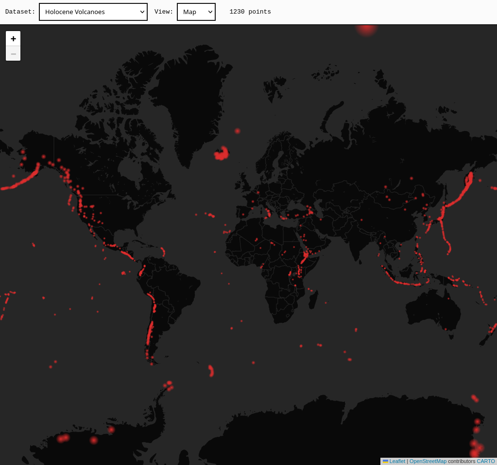
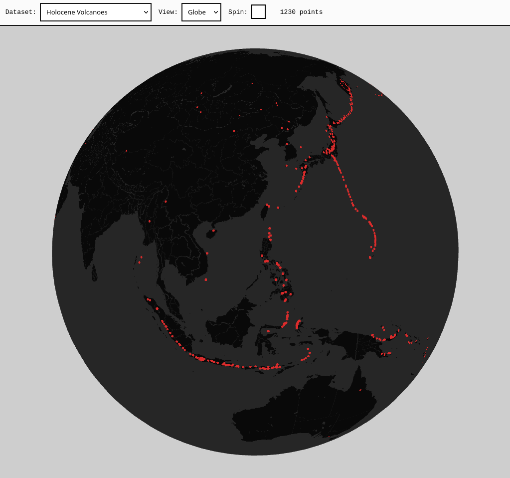
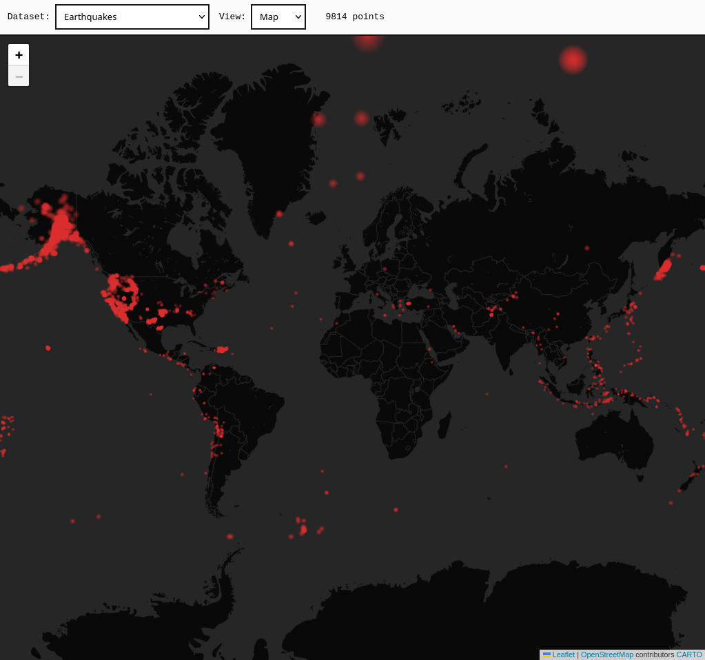
Global Geospatial Data Visualiser
Web app built with TypeScript, React, Node.js (Express), Leaflet
and Three.js. It renders large-scale point datasets on an
interactive 2D map and 3D globe, allowing spatial patterns to be
identified between them.
The app automatically processes GeoJSON Point features and is
specifically designed for discrete geographic location data, where
each point represents an actual place on Earth's surface.
The 2D view is a Leaflet based interactive map with Mercator
projection point overlay. The 3D view is a Three.js sphere with an
equirectangular surface map and point texture derived from the
Leaflet view. The tileset used is provided by
CARTO
but any supported tileset could be mapped to the globe via this
method.
Repo